₱2,100.00
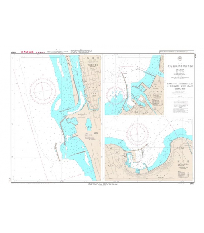
Reference: W40A
Out of stock
Shipping to Metro Manila.
Country / region Select a country / region… AfghanistanÅland IslandsAlbaniaAlgeriaAmerican SamoaAndorraAngolaAnguillaAntarcticaAntigua and BarbudaArgentinaArmeniaArubaAustraliaAustriaAzerbaijanBahamasBahrainBangladeshBarbadosBelarusBelauBelgiumBelizeBeninBermudaBhutanBoliviaBonaire, Saint Eustatius and SabaBosnia and HerzegovinaBotswanaBouvet IslandBrazilBritish Indian Ocean TerritoryBruneiBulgariaBurkina FasoBurundiCambodiaCameroonCanadaCape VerdeCayman IslandsCentral African RepublicChadChileChinaChristmas IslandCocos (Keeling) IslandsColombiaComorosCongo (Brazzaville)Congo (Kinshasa)Cook IslandsCosta RicaCroatiaCubaCuraçaoCyprusCzech RepublicDenmarkDjiboutiDominicaDominican RepublicEcuadorEgyptEl SalvadorEquatorial GuineaEritreaEstoniaEswatiniEthiopiaFalkland IslandsFaroe IslandsFijiFinlandFranceFrench GuianaFrench PolynesiaFrench Southern TerritoriesGabonGambiaGeorgiaGermanyGhanaGibraltarGreeceGreenlandGrenadaGuadeloupeGuamGuatemalaGuernseyGuineaGuinea-BissauGuyanaHaitiHeard Island and McDonald IslandsHondurasHong KongHungaryIcelandIndiaIndonesiaIranIraqIrelandIsle of ManIsraelItalyIvory CoastJamaicaJapanJerseyJordanKazakhstanKenyaKiribatiKuwaitKyrgyzstanLaosLatviaLebanonLesothoLiberiaLibyaLiechtensteinLithuaniaLuxembourgMacaoMadagascarMalawiMalaysiaMaldivesMaliMaltaMarshall IslandsMartiniqueMauritaniaMauritiusMayotteMexicoMicronesiaMoldovaMonacoMongoliaMontenegroMontserratMoroccoMozambiqueMyanmarNamibiaNauruNepalNetherlandsNew CaledoniaNew ZealandNicaraguaNigerNigeriaNiueNorfolk IslandNorth KoreaNorth MacedoniaNorthern Mariana IslandsNorwayOmanPakistanPalestinian TerritoryPanamaPapua New GuineaParaguayPeruPhilippinesPitcairnPolandPortugalPuerto RicoQatarReunionRomaniaRussiaRwandaSão Tomé and PríncipeSaint BarthélemySaint HelenaSaint Kitts and NevisSaint LuciaSaint Martin (Dutch part)Saint Martin (French part)Saint Pierre and MiquelonSaint Vincent and the GrenadinesSamoaSan MarinoSaudi ArabiaSenegalSerbiaSeychellesSierra LeoneSingaporeSlovakiaSloveniaSolomon IslandsSomaliaSouth AfricaSouth Georgia/Sandwich IslandsSouth KoreaSouth SudanSpainSri LankaSudanSurinameSvalbard and Jan MayenSwedenSwitzerlandSyriaTaiwanTajikistanTanzaniaThailandTimor-LesteTogoTokelauTongaTrinidad and TobagoTunisiaTurkeyTurkmenistanTurks and Caicos IslandsTuvaluUgandaUkraineUnited Arab EmiratesUnited Kingdom (UK)United States (US)United States (US) Minor Outlying IslandsUruguayUzbekistanVanuatuVaticanVenezuelaVietnamVirgin Islands (British)Virgin Islands (US)Wallis and FutunaWestern SaharaYemenZambiaZimbabwe
State / County Select an option… AbraAgusan del NorteAgusan del SurAklanAlbayAntiqueApayaoAuroraBasilanBataanBatanesBatangasBenguetBiliranBoholBukidnonBulacanCagayanCamarines NorteCamarines SurCamiguinCapizCatanduanesCaviteCebuCompostela ValleyCotabatoDavao del NorteDavao del SurDavao OccidentalDavao OrientalDinagat IslandsEastern SamarGuimarasIfugaoIlocos NorteIlocos SurIloiloIsabelaKalingaLa UnionLagunaLanao del NorteLanao del SurLeyteMaguindanaoMarinduqueMasbateMisamis OccidentalMisamis OrientalMountain ProvinceNegros OccidentalNegros OrientalNorthern SamarNueva EcijaNueva VizcayaOccidental MindoroOriental MindoroPalawanPampangaPangasinanQuezonQuirinoRizalRomblonSamarSaranganiSiquijorSorsogonSouth CotabatoSouthern LeyteSultan KudaratSuluSurigao del NorteSurigao del SurTarlacTawi-TawiZambalesZamboanga del NorteZamboanga del SurZamboanga SibugayMetro Manila
City:
Postcode / ZIP:
Update
If you have shopped with us before, please enter your details below. If you are a new customer, please proceed to the Billing section.
Username or email *Required
Password *Required
Remember me Login
Lost your password?
First name *
Last name *
Company name (optional)
Country / Region *Select a country / region…AfghanistanÅland IslandsAlbaniaAlgeriaAmerican SamoaAndorraAngolaAnguillaAntarcticaAntigua and BarbudaArgentinaArmeniaArubaAustraliaAustriaAzerbaijanBahamasBahrainBangladeshBarbadosBelarusBelauBelgiumBelizeBeninBermudaBhutanBoliviaBonaire, Saint Eustatius and SabaBosnia and HerzegovinaBotswanaBouvet IslandBrazilBritish Indian Ocean TerritoryBruneiBulgariaBurkina FasoBurundiCambodiaCameroonCanadaCape VerdeCayman IslandsCentral African RepublicChadChileChinaChristmas IslandCocos (Keeling) IslandsColombiaComorosCongo (Brazzaville)Congo (Kinshasa)Cook IslandsCosta RicaCroatiaCubaCuraçaoCyprusCzech RepublicDenmarkDjiboutiDominicaDominican RepublicEcuadorEgyptEl SalvadorEquatorial GuineaEritreaEstoniaEswatiniEthiopiaFalkland IslandsFaroe IslandsFijiFinlandFranceFrench GuianaFrench PolynesiaFrench Southern TerritoriesGabonGambiaGeorgiaGermanyGhanaGibraltarGreeceGreenlandGrenadaGuadeloupeGuamGuatemalaGuernseyGuineaGuinea-BissauGuyanaHaitiHeard Island and McDonald IslandsHondurasHong KongHungaryIcelandIndiaIndonesiaIranIraqIrelandIsle of ManIsraelItalyIvory CoastJamaicaJapanJerseyJordanKazakhstanKenyaKiribatiKuwaitKyrgyzstanLaosLatviaLebanonLesothoLiberiaLibyaLiechtensteinLithuaniaLuxembourgMacaoMadagascarMalawiMalaysiaMaldivesMaliMaltaMarshall IslandsMartiniqueMauritaniaMauritiusMayotteMexicoMicronesiaMoldovaMonacoMongoliaMontenegroMontserratMoroccoMozambiqueMyanmarNamibiaNauruNepalNetherlandsNew CaledoniaNew ZealandNicaraguaNigerNigeriaNiueNorfolk IslandNorth KoreaNorth MacedoniaNorthern Mariana IslandsNorwayOmanPakistanPalestinian TerritoryPanamaPapua New GuineaParaguayPeruPhilippinesPitcairnPolandPortugalPuerto RicoQatarReunionRomaniaRussiaRwandaSão Tomé and PríncipeSaint BarthélemySaint HelenaSaint Kitts and NevisSaint LuciaSaint Martin (Dutch part)Saint Martin (French part)Saint Pierre and MiquelonSaint Vincent and the GrenadinesSamoaSan MarinoSaudi ArabiaSenegalSerbiaSeychellesSierra LeoneSingaporeSlovakiaSloveniaSolomon IslandsSomaliaSouth AfricaSouth Georgia/Sandwich IslandsSouth KoreaSouth SudanSpainSri LankaSudanSurinameSvalbard and Jan MayenSwedenSwitzerlandSyriaTaiwanTajikistanTanzaniaThailandTimor-LesteTogoTokelauTongaTrinidad and TobagoTunisiaTurkeyTurkmenistanTurks and Caicos IslandsTuvaluUgandaUkraineUnited Arab EmiratesUnited Kingdom (UK)United States (US)United States (US) Minor Outlying IslandsUruguayUzbekistanVanuatuVaticanVenezuelaVietnamVirgin Islands (British)Virgin Islands (US)Wallis and FutunaWestern SaharaYemenZambiaZimbabwe *Update country / region
Street address *
Apartment, suite, unit, etc. (optional)
Town / City *
State / County * Select an option…AbraAgusan del NorteAgusan del SurAklanAlbayAntiqueApayaoAuroraBasilanBataanBatanesBatangasBenguetBiliranBoholBukidnonBulacanCagayanCamarines NorteCamarines SurCamiguinCapizCatanduanesCaviteCebuCompostela ValleyCotabatoDavao del NorteDavao del SurDavao OccidentalDavao OrientalDinagat IslandsEastern SamarGuimarasIfugaoIlocos NorteIlocos SurIloiloIsabelaKalingaLa UnionLagunaLanao del NorteLanao del SurLeyteMaguindanaoMarinduqueMasbateMisamis OccidentalMisamis OrientalMountain ProvinceNegros OccidentalNegros OrientalNorthern SamarNueva EcijaNueva VizcayaOccidental MindoroOriental MindoroPalawanPampangaPangasinanQuezonQuirinoRizalRomblonSamarSaranganiSiquijorSorsogonSouth CotabatoSouthern LeyteSultan KudaratSuluSurigao del NorteSurigao del SurTarlacTawi-TawiZambalesZamboanga del NorteZamboanga del SurZamboanga SibugayMetro Manila
Postcode / ZIP *
Phone (optional)
Email address *
Create an account?
Account username *
Create account password *
Order notes (optional)
Pay securely using your VISA and MasterCard credit, debit, or prepaid card.
Pay via PayPal; you can pay with your credit card if you don’t have a PayPal account.
Please send a check to Store Name, Store Street, Store Town, Store State / County, Store Postcode.
Make your payment directly into our bank account. Please use your Order ID as the payment reference. Your order will not be shipped until the funds have cleared in our account.
Simple and easy payments via GCash.
Username or email address *Required
Remember me Log in
Username *Required
Email address *Required
Register
 Japanese Chart JP16 Muroran Ko
1 × ₱2,100.00
Japanese Chart JP16 Muroran Ko
1 × ₱2,100.00


Reviews
There are no reviews yet.