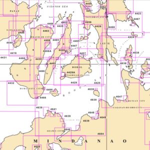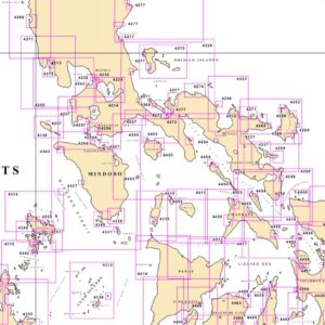
Philippine Charts
NAMRIA conducts hydrographic and physical oceanographic surveys and produces nautical charts (berthing, harbor, approach, coastal, general sailing and overview charts), predicted tide and current tables, coast pilot book, list of lights, notices to mariners and other nautical publications depicting the country’s maritime jurisdictions. The surveys and charts ensure safety in maritime navigation and provide basic information for the management of the maritime space and resources, as well as base data for climate change studies. The charts and hydrographic data are important in complying with the provisions of the United Nations Convention on the Law of the Sea relative to the country’s maritime entitlements. Likewise, the nautical publications are required under the Safety of Life at Sea Convention.
Shop Philippine Charts now