-
- Philippine Charts
1539 Samar Sea and Eastern Part of Visayan Sea
- ₱2,000.00
- NAMRIA CHART 1539
- Add to cart
-
- Philippine Charts
1540 Sibuyan to Bantayan Island (2nd Edition October 2023)
- ₱2,000.00
- NAMRIA CHART 1540
- Add to cart
-
- Philippine Charts
1541 Sibuyan Sea to Ticao Pass
- ₱2,000.00
- NAMRIA CHART 1541 COLORED
- Add to cart
-
- Philippine Charts
1542 Tayabas Bay to Burias Pass including Ragay Gulf
- ₱1,000.00
- NAMRIA CHART 1542 COLORED
- Add to cart
-
- Philippine Charts
1543 Romblon Passage to Tayabas Bay including Tablas Strait
- ₱1,000.00
- Provides key hydrographic and navigational data for safe passage between Romblon Passage, Tablas Strait, and Tayabas Bay.
- Add to cart
-
- Philippine Charts
1544 Ambulong Island to Sibuyan Island including Semirara Island
- ₱2,000.00
- NAMRIA CHART 1544 COLORED
- Add to cart
-
- Philippine Charts
1545 Cuyo East Pass
- ₱2,000.00
- NAMRIA CHART 1545 COLORED
- Add to cart
-
- Philippine Charts
1546 Panay Gulf and Approaches (2nd Edition December 2022)
- ₱2,000.00
- NAMRIA CHART 1546 COLORED
- Add to cart
-
- Philippine Charts
1547 Apo Island to Danjugan Island
- ₱1,000.00
- 1547 – Apo Island to Danjugan Island is a nautical chart providing hydrographic information for safe navigation between Apo Island and Danjugan Island. It includes depth soundings, reef locations, and navigational hazards to support safe and efficient inter-island passage.
- Add to cart
-
- Philippine Charts
1548 Southern Part of Tanon Strait and Cebu Strait to Bohol Sea
- ₱1,000.00
- NAMRIA CHART 1548 COLORED
- Add to cart
-
- Philippine Charts
1549 The Passages Between Panay Negros and Cebu
- ₱2,000.00
- NAMRIA CHART 1549 COLORED
- Add to cart
-
- Philippine Charts
1550 Cagayan Island to Panay Island
- ₱2,000.00
- 1550 – Cagayan Island to Panay Island is a nautical chart providing essential hydrographic information for safe navigation between Cagayan Island and Panay Island. It includes depth soundings, coastal features, and navigational hazards, supporting efficient route planning and safe inter-island passage.
- Add to cart
-
- Philippine Charts
1551 Cuyo West Pass (2nd Edition November 2022)
- ₱2,000.00
- NAMRIA CHART 1551 COLORED
- Add to cart
-
- Philippine Charts
1552 Mindoro Strait
- ₱1,000.00
- NAMRIA CHART 1552 COLORED
- Add to cart
-
- Philippine Charts
1553 Apo West Pass to Linapacan Island
- ₱2,000.00
- Chart No. 1553 – Apo West Pass to Linapacan Island is a reliable nautical chart covering key waters of Palawan. It provides essential navigation details such as depth soundings, reefs, shoals, and coastal features between Apo West Pass and Linapacan Island, making it ideal for safe route planning and marine operations.
- Add to cart
-
- Philippine Charts
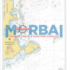
1554 Linapacan Island to Charybdis Shoal
- ₱1,000.00
- Chart No. 1554 – Linapacan Island to Charybdis Shoal is a nautical chart featuring essential navigation data, including depths, reefs, and hazards, for safe passage between Linapacan Island and Charybdis Shoal.
- Add to cart
-
- Philippine Charts
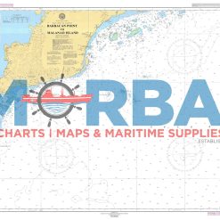
1555 Barbacan Point to Malinao Point
- ₱2,000.00
- Chart No. 1555 – Barbacan Point to Malinao Point is a nautical chart covering the coastal waters between Barbacan Point and Malinao Point, providing essential depth soundings, coastal features, and navigational hazards for safe coastal navigation.
- Add to cart
-
- Philippine Charts
1556 Malanao Island to Filantropia Point
- ₱2,000.00
- 1556 – Malanao Island to Filantropia Point is a nautical chart providing hydrographic data for safe coastal navigation between Malanao Island and Filantropia Point. It includes depth soundings, shoreline features, and navigational hazards to support safe and efficient nearshore passage.
- Add to cart
-
- Philippine Charts
1557 North Balabac Strait
- ₱2,000.00
- NAMRIA CHART 1557 COLORED
- Add to cart
-
- Philippine Charts
1558 Balabac Strait
- ₱1,000.00
- NAMRIA CHART 1558 COLORED
- Add to cart
-
- Philippine Charts
1559 Danger Bank to Mapun Island
- ₱2,000.00
- Chart 1559 – Danger Bank to Mapun Island covers the offshore waters between Danger Bank and Mapun Island in Tawi-Tawi. This nautical chart provides essential hydrographic information for safe offshore navigation, including depth soundings and navigational hazards such as reefs and shoals.
- Add to cart
-
- Philippine Charts
1560 Malanut Bay to Canipan Bay
- ₱2,000.00
- Chart No. 1560 – Malanut Bay to Canipan Bay is a nautical chart covering the waters between Malanut Bay and Canipan Bay, providing essential depth soundings and navigational hazards for safe coastal navigation.
- Add to cart
-
- Philippine Charts
1561 Malapackun Island to Camungyan Island
- ₱2,000.00
- Chart No. 1561 – Malapackun Island to Camungyan Island A nautical chart covering the coastal waters between Malapackun Island and Camungyan Island. It provides essential depth soundings, coastal features, and navigational hazards, supporting safe and efficient nearshore and inter-island navigation.
- Add to cart
-
- Philippine Charts
1562 Tuluran Island to Ulugan Bay
- ₱2,000.00
- Chart 1562 – Tuluran Island to Ulugan Bay: A nautical chart by the National Mapping and Resource Information Authority covering the waters from Tuluran Island to Ulugan Bay in Palawan, showing depths, coastal features, hazards, and navigation aids for safe marine navigation.
- Add to cart
-
- Philippine Charts
1563 Capoas Cluster to Malubut Glubut Island
- ₱1,000.00
- 1563 – Capoas Cluster to Malubut Glubut Island is a nautical chart providing essential hydrographic details for safe navigation in the remote waters of northern Palawan, particularly within the Linapacan area. It includes depth soundings, reef and hazard locations, and coastal features, supporting efficient route planning for vessels operating between island groups and routes linking Coron and El Nido.
- Add to cart
-
- Philippine Charts
1564 Verde Island Passage
- ₱1,000.00
- NAMRIA CHART 1564 COLORED
- Add to cart
-
- Philippine Charts
1565 Mapun Island to Normanby Bank
- ₱2,000.00
- Chart No. 1565 – Mapun Island to Normanby Bank is a nautical chart providing essential navigation data, including depths, reefs, and hazards, for safe passage between Mapun Island and Normanby Bank.
- Add to cart
-
- Others, Philippine Charts
1566 Tubbataha Reefs and Vicinity
- ₱2,000.00
- Chart No. 1566 – Tubbataha Reefs and Vicinity is a nautical chart covering the waters around Tubbataha Reefs Natural Park, providing essential depth soundings, reef features, and navigational hazards for safe offshore navigation.
- Add to cart
-

- Out of Stock
- Divider and Rulers
178 Divider Millenium Navigation kit
- ₱3,400.00
- #178
- Read more
-
-
- Divider and Rulers
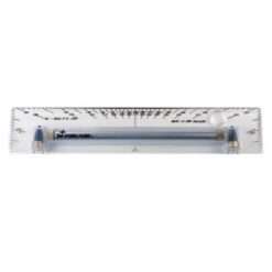
20″ Bi-Rola Rule (PR 500 Rolling Plotter)
- ₱8,500.00
- Item #: 220
- Add to cart
-
- Instruments
2024 Wayfinding tape
- ₱6,100.00
- Reference: MP2024 40mm wide x 10m; Photoluminescent, self-adhesive vinyl
- Add to cart
-
- Instruments
2028 Wayfinding tape
- ₱6,100.00
- Reference: MP2028 80mm wide x 10m; Photoluminescent, self-adhesive vinyl
- Add to cart
-
- Instruments
2034 Green diagonal Photoluminescent tape
- ₱6,100.00
- Reference: MP2034 40mm wide x 10m; Photoluminescent, self-adhesive vinyl
- Add to cart
-
- Instruments
2038 Green diagonal Photoluminescent tape
- ₱6,100.00
- Reference: MP2038 80mm wide x 10m; Photoluminescent, self-adhesive vinyl
- Add to cart
-
- Instruments
2044 Black diagonal Photoluminescent tape
- ₱6,100.00
- Reference: MP2044 40mm wide x 10m; Photoluminescent, self-adhesive vinyl
- Add to cart
-
- Instruments
2048 Black diagonal Photoluminescent tape
- ₱6,100.00
- Reference: MP2048 80mm wide x 10m; Photoluminescent, self-adhesive vinyl
- Add to cart
-
- Instruments
2054 Red diagonal Photoluminescent tape
- ₱6,100.00
- Reference: MP2054 40mm wide x 10m; Photoluminescent, self-adhesive vinyl
- Add to cart
-
- Instruments
2058 Red diagonal Photoluminescent tape
- ₱6,100.00
- Reference: MP2058 80mm wide x 10m; Photoluminescent, self-adhesive vinyl
- Add to cart
-
- Instruments
2086 Rigid Trail marker arrow dots
- ₱6,100.00
- Reference: MP2086 60mm Dia, Pack of 10; Photoluminescent, rigid PVC
- Add to cart
-
- Instruments, Navigation Tools
2088 Rigid Trail marker arrow dots
- ₱6,100.00
- Reference: MP2088 80mm Dia, Pack of 10; Photoluminescent, rigid PVC
- Add to cart
-
- Instruments
2096 Rigid marker dots
- ₱6,100.00
- Reference: MP2096 60mm Dia, Pack of 10; Photoluminescent, rigid PVC
- Add to cart
-
- Instruments
2098 Rigid marker dots
- ₱6,100.00
- Reference: MP2098 80mm Dia, Pack of 10; Photoluminescent, rigid PVC
- Add to cart
-
- Instruments
2101 Green Pipe Tape 150mm x 30m
- ₱6,100.00
- Reference: MP2101 150mm x 30m; Coloured vinyl or coloured polyethlene
- Add to cart
-
- Instruments
2102 Silver/Grey Pipe Tape 150mm x 30m
- ₱6,100.00
- Reference: MP2102 150mm x 30m; Coloured vinyl or coloured polyethlene
- Add to cart
-
- Instruments
2103 Brown Pipe Tape 150mm x 30m
- ₱6,100.00
- Reference: MP2103 150mm x 30m; Coloured vinyl or coloured polyethlene
- Add to cart
-
- Instruments
2104 Yellow Ochre Pipe Tape 150mm x 30m
- ₱6,100.00
- Reference: MP2104 150mm x 30m; Coloured vinyl or coloured polyethlene
- Add to cart
-
- Instruments
2105 Violet Pipe Tape 150mm x 30m
- ₱6,100.00
- Reference: MP2105 150mm x 30m; Coloured vinyl or coloured polyethlene
- Add to cart
-
- Instruments
2106 Light Blue Pipe Tape 150mm x 30m
- ₱6,100.00
- Reference: MP2106 150mm x 30m; Coloured vinyl or coloured polyethlene
- Add to cart
-
- Instruments
2107 Black Pipe Tape 150mm x 30m
- ₱6,100.00
- Reference: MP2107 150mm x 30m; Coloured vinyl or coloured polyethlene
- Add to cart
-
- Instruments
2108 Orange Pipe Tape 150mm x 30m
- ₱6,100.00
- Reference: MP2108 150mm x 30m; Coloured vinyl or coloured polyethlene
- Add to cart
-
- Instruments
2111 Red Pipe Tape 50mm x 30m
- ₱6,100.00
- Reference: MP2111 50mm x 30m; Coloured vinyl or coloured polyethlene
- Add to cart
-
- Instruments
2112 Primrose Pipe Tape 50mm x 30m
- ₱6,100.00
- Reference: MP2112 50mm x 30m; Coloured vinyl or coloured polyethlene
- Add to cart
-
- Instruments
2113 Auxiliary Blue Pipe Tap 50mm x 30m
- ₱6,100.00
- Reference: MP2113 50mm x 30m; Coloured vinyl or coloured polyethlene
- Add to cart
-
- Instruments
2114 Crimson Pipe Tape 50mm x 30m
- ₱6,100.00
- Reference: MP2114 50mm x 30m; Coloured vinyl or coloured polyethlene
- Add to cart
-
- Instruments
2115 Emerald Green Pipe Tape 50mm x 30m
- ₱6,100.00
- Reference: MP2115 50mm x 30m; Coloured vinyl or coloured polyethlene
- Add to cart
-
- Instruments
2116 Salmon Pink Pipe Tape 50mm x 30m
- ₱6,100.00
- Reference: MP2116 50mm x 30m; Coloured vinyl or coloured polyethlene
- Add to cart
-
- Instruments
2117 White Pipe Tape 50mm x 30m
- ₱6,100.00
- Reference: MP2117 50mm x 30m; Coloured vinyl or coloured polyethlene
- Add to cart
-
- Instruments
2118 Blue Pipe Tape 50mm x 30m
- ₱6,100.00
- Reference: MP2118 50mm x 30m; Coloured vinyl or coloured polyethlene
- Add to cart
-
- Instruments
2119 Sea Green Pipe Tape 50mm x 30m
- ₱6,100.00
- Reference: MP2119 50mm x 30m; Coloured vinyl or coloured polyethlene
- Add to cart
-
- Instruments
2120 Golden Brown Pipe Tape 50mm x 30m
- ₱6,100.00
- Reference: MP2120 50mm x 30m; Coloured vinyl or coloured polyethlene
- Add to cart
-
- Instruments
2121 Dark Mauve Pipe Tape 50mm x 30m
- ₱6,100.00
- Reference: MP2121 50mm x 30m; Coloured vinyl or coloured polyethlene
- Add to cart
-
- Instruments
2130 Maritime Progress 50mm x 30m Flow Arrows, Pipe Tape
- ₱6,100.00
- Reference: MP2130 50mm x 30m; Coloured vinyl or coloured polyethlene
- Add to cart
-
- Instruments
2140 Maritime Progress Black Pipe Tape 50mm x 30m
- ₱6,100.00
- Reference: MP2140 50mm x 30m; Coloured vinyl or coloured polyethlene
- Add to cart
-
- Instruments
2141 Maritime Progress Blue Pipe Tape 50mm x 30m
- ₱6,100.00
- Reference: MP2141 50mm x 30m; Coloured vinyl or coloured polyethlene
- Add to cart
-
- Instruments
2142 Maritime Progress Brown Pipe Tape 50mm x 30m
- ₱6,100.00
- Reference: MP2142 50mm x 30m; Coloured vinyl or coloured polyethlene
- Add to cart
-
- Instruments
2143 Maritime Progress Green Pipe Tape 50mm x 30m
- ₱6,100.00
- Reference: MP2143 50mm x 30m; Coloured vinyl or coloured polyethlene
- Add to cart
-
- Instruments
2144CV Maritime Progress Grey Pipe Tape 50mm x 30m
- ₱6,100.00
- Reference: MP2144 50mm x 30m; Coloured vinyl or coloured polyethlene
- Add to cart
-
- Instruments
2145 Maritime Progress Maroon Pipe Tape 50mm x 30m
- ₱6,100.00
- Reference: MP2145 50mm x 30m; Coloured vinyl or coloured polyethlene
- Add to cart
-
- Instruments
2146 Maritime Progress Orange Pipe Tape 50mm x 30m
- ₱6,100.00
- Reference: MP2146 50mm x 30m; Coloured vinyl or coloured polyethlene
- Add to cart
-
- Instruments
2147 Maritime Progress Silver Pipe Tape 50mm x 30m
- ₱6,100.00
- Reference: MP2147 50mm x 30m; Coloured vinyl or coloured polyethlene
- Add to cart
-
- Instruments
2148 Maritime Progress Red Pipe Tape 50mm x 30m
- ₱6,100.00
- Reference: MP2148 50mm x 30m; Coloured vinyl or coloured polyethlene
- Add to cart
-
- Instruments
2149 Maritime Progress Violet Pipe Tape 50mm x 30m
- ₱6,100.00
- Reference: MP2149 50mm x 30m; Coloured vinyl or coloured polyethlene
- Add to cart
-
- Instruments
2150 Maritime Progress White Pipe Tape 50mm x 30m
- ₱6,100.00
- Reference: MP2150 50mm x 30m; Coloured vinyl or coloured polyethylene
- Add to cart
-
- Instruments
2151 Maritime Progress Yellow-ochre Pipe Tape 50mm x 30m
- ₱6,100.00
- Reference: MP2151 50mm x 30m; Coloured vinyl or coloured polyethlene
- Add to cart
-
- Witherby Seamanship
21st Century Seamanship 1st edition 2015
- ₱16,500.00
- Published by Witherby Seamanship International Ltd(2015) ISBN 10: 1856096327 ISBN 13: 9781856096324
- Add to cart
-
- Philippine Charts
2200 Philippine Archipelago
- ₱2,000.00
- Chart no. 2200 Edition: 1st, August 28, 2020 Depths in Meters WGS84 POSITIONS Replacement of Chart no. 4200
- Add to cart
-
- Out of Stock
- Philippine Charts
4204 Balintang Channel – Luzon Strait
- ₱400.00
- Cancelled; Replaced by: 1506 Dalupiri Island to Batan Island
- Read more
-
-
- Out of Stock
- Philippine Charts
4205 Batan Islands
- Cancelled; Replaced by: 1507 Bashi Channel to Batan Island
- Read more
-
-
- Out of Stock
- Philippine Charts
4206 Pata Point to Cape Bojeador
- Cancelled; Replaced by: 1505 Cape Bojeador to Calayan Island
- Read more
-
-
- Out of Stock
- Philippine Charts
4207 Cape Bojeador to Vigan
- ₱550.00
- Cancelled; Replaced by: 1504 Candon Anchorage to Cape Bojeador
- Read more
-
-
- Out of Stock
- Philippine Charts
4208 Vigan To San Fernando (Port Tagudin)
- Cancelled Replace by: 1503 Dasol Bay to Candon Anchorage
- Read more
-
-
- Out of Stock
- Philippine Charts
4209 Lingayen Gulf
- Cancelled Replace by: 1503 Dasol Bay to Candon Anchorage
- Read more
-
-
- Out of Stock
- Philippine Charts
4210 Dasol Bay to Capones Islands (Sta Cruz Inner Harbour / Iba Anchorage)
- Cancelled Replace by: 1502 Subic Bay to Dasol Bay
- Read more
-
-
- Out of Stock
- Philippine Charts
4211 Approaches to Manila Bay
- Cancelled Replace by: 1501 Manila Bay and Approaches
- Read more
-
-
- Philippine Charts
4212 Subic Bay
- ₱550.00
- NAMRIA CHART 4212 Colored
- Add to cart
-
- Philippine Charts
4213 Port of Olongapo and Vicinity
- ₱550.00
- NAMRIA CHART 4213 Colored
- Add to cart
-
- Philippine Charts
4214 Verde Island Passage (Replaced by 1564)
- ₱1,000.00
- NAMRIA CHART 4214 CANCELLED NEW CHART NAMRIA 1564 COLORED
- Add to cart
-
- Philippine Charts
4215 Olongapo Inner Bay
- ₱2,000.00
- A nautical chart of the inner harbor of Olongapo within Subic Bay, providing detailed depth data, port features, and navigational information for safe harbor operations.
- Add to cart
-
- Out of Stock
- Philippine Charts
4218 Ragay Gulf to Tayabas Bay (Vinas River)
- Cancelled Replace by: 1542 Tayabas Bay to Burias Pass including Ragay Gulf
- Read more
-
-
- Out of Stock
- Philippine Charts
4219 Passage Between Luzon and Masbate and Sorsogon Bay
- Cancelled Replace by: 1549 The Passages Between Panay Negros and Cebu
- Read more
-
-
- Out of Stock
- Philippine Charts
4220 San Bernardino Strait and Samar Island (Biri Anchorage, Mauo River )
- Cancelled Replace by: 1515 Approaches to San Bernardino Strait including Albay Gulf and Lagonoy Gulf
- Read more
-
-
- Out of Stock
- Philippine Charts
4221 Albay Gulf and Part of Lagonoy Gulf
- Cancelled; Replaced by 1516 Cabaun Island to Gamay Bay
- Read more
-
-
- Out of Stock
- Philippine Charts
4222 Lagonoy Gulf to Lamit Bay and Catanduanes Island
- Cancelled Replace by: 1514 Canimo Island to Catanduanes Island
- Read more
-
-
- Out of Stock
- Philippine Charts
4223 San Miguel and Lamit Bays
- Cancelled Replace by: >1514 Canimo Island to Catanduanes Island )
- Read more
-
-
- Out of Stock
- Philippine Charts
4226 Lamon Bay and Polillo Islands
- Cancelled Replace by: 1513 Lamon Bay
- Read more
-
-
- Out of Stock
- Philippine Charts
4227 Digillorin Bay to Dingalan Bay (Diapitan Bay)
- ₱400.00
- Cancelled Replace by: 1510 Lobo Point to Dijohan Point 1511 Tarigtig Point to Dicapanisan Point
- Read more
-
-
- Out of Stock
- Philippine Charts
4228 Cape Engano to Digollorin Point
- ₱400.00
- Cancelled Replace by: 1509 Cape Engano to Lobod Point
- Read more
-