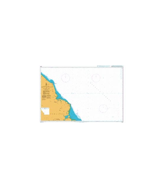
British Admiralty Nautical Chart 3920 Ujung Peureula to Teluk Aru
₱3,500.00
BA3920
British Admiralty Nautical Chart 3920 Ujung Peureula to Teluk Aru
is corrected up to date. Admiralty standard nautical charts comply with Safety of Life at Sea (SOLAS) regulations and are ideal for professional, commercial and recreational use. Charts within the series consist of a range of scales, useful for passage planning, ocean crossings, coastal navigation and entering port. Mariners should always use the largest scale nautical chart appropriate to their needs. In particularly busy seaways such as the English Channel, Gulf of Suez and the Malacca and Singapore Straits, the standard nautical charts are supplemented by mariners routeing guides which provide advice on route planning in these complex areas.
Chart 3920
Main Chart Details
Chart Title: Ujung Peureula to Teluk Aru
Publication Date: 04/03/1994
Latest Edition date: 06/06/2019
Chart Size: 980 x 640 (mm)
Chart Panel Details
Panel Name Ujung Peureula to Teluk Aru
Natural Scale 200000
North Limit 5 13′.40N
East Limit 99 24′.90E
South Limit 4 04′.00N
West Limit 97 39′.00E
Be the first to review “British Admiralty Nautical Chart 3920 Ujung Peureula to Teluk Aru”
Related products


British Admiralty Charts
British Admiralty Nautical Chart 32: England – South Coast, Falmouth to Truro

British Admiralty Charts
British Admiralty Nautical Chart 5: `Abd Al Kuri to Suqutra (Socotra)
British Admiralty Charts
British Admiralty Nautical Chart 34: England – West Coast, Isles of Scilly
Reviews
There are no reviews yet.