-
- Philippine Charts
1535 Lanboyan Point to Initao Point
- ₱1,000.00
- NAMRIA CHART 1535
- Add to cart
-
- Philippine Charts
1536 Initao Point to Butuan Bay (North Coast of Mindanao)
- ₱2,000.00
- NAMRIA CHART 1536
- Add to cart
-
- Philippine Charts
1537 Bohol Sea Southern Approaches to Canigao Channel
- ₱2,000.00
- NAMRIA CHART 1537
- Add to cart
-
- Philippine Charts
1538 Camotes Sea
- ₱1,000.00
- NAMRIA CHART 1538
- Add to cart
-
- Philippine Charts
1539 Samar Sea and Eastern Part of Visayan Sea
- ₱2,000.00
- NAMRIA CHART 1539
- Add to cart
-
- Philippine Charts
1540 Sibuyan to Bantayan Island (2nd Edition October 2023)
- ₱2,000.00
- NAMRIA CHART 1540
- Add to cart
-
- Philippine Charts
1541 Sibuyan Sea to Ticao Pass
- ₱2,000.00
- NAMRIA CHART 1541 COLORED
- Add to cart
-
- Philippine Charts
1542 Tayabas Bay to Burias Pass including Ragay Gulf
- ₱1,000.00
- NAMRIA CHART 1542 COLORED
- Add to cart
-
- Philippine Charts
1543 Romblon Passage to Tayabas Bay including Tablas Strait
- ₱1,000.00
- Provides key hydrographic and navigational data for safe passage between Romblon Passage, Tablas Strait, and Tayabas Bay.
- Add to cart
-
- Philippine Charts
1544 Ambulong Island to Sibuyan Island including Semirara Island
- ₱2,000.00
- NAMRIA CHART 1544 COLORED
- Add to cart
-
- Philippine Charts
1545 Cuyo East Pass
- ₱2,000.00
- NAMRIA CHART 1545 COLORED
- Add to cart
-
- Philippine Charts
1546 Panay Gulf and Approaches (2nd Edition December 2022)
- ₱2,000.00
- NAMRIA CHART 1546 COLORED
- Add to cart
-
- Philippine Charts
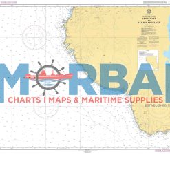
1547 Apo Island to Danjugan Island
- ₱1,000.00
- 1547 – Apo Island to Danjugan Island is a nautical chart providing hydrographic information for safe navigation between Apo Island and Danjugan Island. It includes depth soundings, reef locations, and navigational hazards to support safe and efficient inter-island passage.
- Add to cart
-
- Philippine Charts
1548 Southern Part of Tanon Strait and Cebu Strait to Bohol Sea
- ₱1,000.00
- NAMRIA CHART 1548 COLORED
- Add to cart
-
- Philippine Charts
1549 The Passages Between Panay Negros and Cebu
- ₱2,000.00
- NAMRIA CHART 1549 COLORED
- Add to cart
-
- Philippine Charts
1550 Cagayan Island to Panay Island
- ₱2,000.00
- 1550 – Cagayan Island to Panay Island is a nautical chart providing essential hydrographic information for safe navigation between Cagayan Island and Panay Island. It includes depth soundings, coastal features, and navigational hazards, supporting efficient route planning and safe inter-island passage.
- Add to cart
-
- Philippine Charts
1551 Cuyo West Pass (2nd Edition November 2022)
- ₱2,000.00
- NAMRIA CHART 1551 COLORED
- Add to cart
-
- Philippine Charts
1552 Mindoro Strait
- ₱1,000.00
- NAMRIA CHART 1552 COLORED
- Add to cart
-
- Philippine Charts
1553 Apo West Pass to Linapacan Island
- ₱2,000.00
- Chart No. 1553 – Apo West Pass to Linapacan Island is a reliable nautical chart covering key waters of Palawan. It provides essential navigation details such as depth soundings, reefs, shoals, and coastal features between Apo West Pass and Linapacan Island, making it ideal for safe route planning and marine operations.
- Add to cart
-
- Philippine Charts
1554 Linapacan Island to Charybdis Shoal
- ₱1,000.00
- Chart No. 1554 – Linapacan Island to Charybdis Shoal is a nautical chart featuring essential navigation data, including depths, reefs, and hazards, for safe passage between Linapacan Island and Charybdis Shoal.
- Add to cart
-
- Philippine Charts
1555 Barbacan Point to Malinao Point
- ₱2,000.00
- Chart No. 1555 – Barbacan Point to Malinao Point is a nautical chart covering the coastal waters between Barbacan Point and Malinao Point, providing essential depth soundings, coastal features, and navigational hazards for safe coastal navigation.
- Add to cart
-
- Philippine Charts
1556 Malanao Island to Filantropia Point
- ₱2,000.00
- 1556 – Malanao Island to Filantropia Point is a nautical chart providing hydrographic data for safe coastal navigation between Malanao Island and Filantropia Point. It includes depth soundings, shoreline features, and navigational hazards to support safe and efficient nearshore passage.
- Add to cart
-
- Philippine Charts
1557 North Balabac Strait
- ₱2,000.00
- NAMRIA CHART 1557 COLORED
- Add to cart
-
- Philippine Charts
1558 Balabac Strait
- ₱1,000.00
- NAMRIA CHART 1558 COLORED
- Add to cart