-
- Instruments
2145 Maritime Progress Maroon Pipe Tape 50mm x 30m
- ₱6,100.00
- Reference: MP2145 50mm x 30m; Coloured vinyl or coloured polyethlene
- Add to cart
-
- Instruments
2146 Maritime Progress Orange Pipe Tape 50mm x 30m
- ₱6,100.00
- Reference: MP2146 50mm x 30m; Coloured vinyl or coloured polyethlene
- Add to cart
-
- Instruments
2147 Maritime Progress Silver Pipe Tape 50mm x 30m
- ₱6,100.00
- Reference: MP2147 50mm x 30m; Coloured vinyl or coloured polyethlene
- Add to cart
-
- Instruments
2148 Maritime Progress Red Pipe Tape 50mm x 30m
- ₱6,100.00
- Reference: MP2148 50mm x 30m; Coloured vinyl or coloured polyethlene
- Add to cart
-
- Instruments
2149 Maritime Progress Violet Pipe Tape 50mm x 30m
- ₱6,100.00
- Reference: MP2149 50mm x 30m; Coloured vinyl or coloured polyethlene
- Add to cart
-
- Instruments
2150 Maritime Progress White Pipe Tape 50mm x 30m
- ₱6,100.00
- Reference: MP2150 50mm x 30m; Coloured vinyl or coloured polyethylene
- Add to cart
-
- Instruments
2151 Maritime Progress Yellow-ochre Pipe Tape 50mm x 30m
- ₱6,100.00
- Reference: MP2151 50mm x 30m; Coloured vinyl or coloured polyethlene
- Add to cart
-
- Witherby Seamanship
21st Century Seamanship 1st edition 2015
- ₱16,500.00
- Published by Witherby Seamanship International Ltd(2015) ISBN 10: 1856096327 ISBN 13: 9781856096324
- Add to cart
-
- Philippine Charts
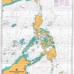
2200 Philippine Archipelago
- ₱2,000.00
- Chart no. 2200 Edition: 1st, August 28, 2020 Depths in Meters WGS84 POSITIONS Replacement of Chart no. 4200
- Add to cart
-
- Out of Stock
- Philippine Charts
4204 Balintang Channel – Luzon Strait
- ₱400.00
- Cancelled; Replaced by: 1506 Dalupiri Island to Batan Island
- Read more
-
-
- Out of Stock
- Philippine Charts
4205 Batan Islands
- Cancelled; Replaced by: 1507 Bashi Channel to Batan Island
- Read more
-
-
- Out of Stock
- Philippine Charts
4206 Pata Point to Cape Bojeador
- Cancelled; Replaced by: 1505 Cape Bojeador to Calayan Island
- Read more
-
-
- Out of Stock
- Philippine Charts
4207 Cape Bojeador to Vigan
- ₱550.00
- Cancelled; Replaced by: 1504 Candon Anchorage to Cape Bojeador
- Read more
-
-
- Out of Stock
- Philippine Charts
4208 Vigan To San Fernando (Port Tagudin)
- Cancelled Replace by: 1503 Dasol Bay to Candon Anchorage
- Read more
-
-
- Out of Stock
- Philippine Charts
4209 Lingayen Gulf
- Cancelled Replace by: 1503 Dasol Bay to Candon Anchorage
- Read more
-
-
- Out of Stock
- Philippine Charts
4210 Dasol Bay to Capones Islands (Sta Cruz Inner Harbour / Iba Anchorage)
- Cancelled Replace by: 1502 Subic Bay to Dasol Bay
- Read more
-
-
- Out of Stock
- Philippine Charts
4211 Approaches to Manila Bay
- Cancelled Replace by: 1501 Manila Bay and Approaches
- Read more
-
-
- Philippine Charts
4212 Subic Bay
- ₱550.00
- NAMRIA CHART 4212 Colored
- Add to cart
-
- Philippine Charts
4213 Port of Olongapo and Vicinity
- ₱550.00
- NAMRIA CHART 4213 Colored
- Add to cart
-
- Philippine Charts
4214 Verde Island Passage (Replaced by 1564)
- ₱1,000.00
- NAMRIA CHART 4214 CANCELLED NEW CHART NAMRIA 1564 COLORED
- Add to cart
-
- Philippine Charts
4215 Olongapo Inner Bay
- ₱2,000.00
- A nautical chart of the inner harbor of Olongapo within Subic Bay, providing detailed depth data, port features, and navigational information for safe harbor operations.
- Add to cart
-
- Out of Stock
- Philippine Charts
4218 Ragay Gulf to Tayabas Bay (Vinas River)
- Cancelled Replace by: 1542 Tayabas Bay to Burias Pass including Ragay Gulf
- Read more
-