-
- Out of Stock
- Philippine Charts
4424 Southeast Coast of Leyte and Dinagat Island (Liloan Bay and Panaon Strait)
- ₱400.00
- Cancelled Replaced by: 1518 Leyte Gulf and Approaches 1519 Surigao Strait and Dinagat Sound
- Read more
-
-
- Out of Stock
- Philippine Charts
4425 Eastern Bohol and Part of Leyte
- ₱400.00
- Cancelled Replaced by: 1537 Bohol Sea Southern Approaches to Canigao Channel
- Read more
-
-
- Out of Stock
- Philippine Charts
4426 Ormoc Bay to Maasin (Ormoc Bay; Maasin; Port Bello; Isabel Leyte)
- ₱400.00
- Cancelled Replaced by: 1538 Camotes Sea
- Read more
-
-
- Out of Stock
- Philippine Charts
4427 East Coast of Cebu
- ₱550.00
- Cancelled Replaced by: 1538 Camotes Sea
- Read more
-
-
- Out of Stock
- Philippine Charts
4428 Northern Part of Tanon Strait
- ₱400.00
- Cancelled Replaced by: 1549 The Passages Between Panay Negros and Cebu 1548 Southern Part of Tanon Strait and Cebu Strait to Bohol Sea
- Read more
-
-
- Out of Stock
- Philippine Charts
4429 Western Bohol
- ₱400.00
- Cancelled Replaced by: 1548 Southern Part of Tanon Strait and Cebu Strait to Bohol Sea
- Read more
-
-
- Philippine Charts
4429A Port of Tagbilaran
- ₱550.00
- NAMRIA CHART 4429A Colored
- Add to cart
-
- Out of Stock
- Philippine Charts
4430 Tanon Strait, Southern Part
- ₱400.00
- Cancelled Replaced by: 1548 Southern Part of Tanon Strait and Cebu Strait to Bohol Sea
- Read more
-
-
- Out of Stock
- Philippine Charts
4431 Western Negros (Asia Bay)
- ₱400.00
- Cancelled Replaced by: 1547 Apo Island to Danjugan Island
- Read more
-
-
- Out of Stock
- Philippine Charts
4432 Southwestern Negros
- ₱400.00
- Cancelled Replaced by: 1547 Apo Island to Danjugan Island
- Read more
-
-

- Philippine Charts
4440 Biri Channel and Vicinity
- ₱400.00
- NAMRIA CHART 4440 BLACK & WHITE
- Add to cart
-
- Philippine Charts
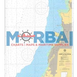
4445 Port of Bacolod
- ₱2,000.00
- Chart 4445 – Port of Bacolod covers the coastal waters around the Port of Bacolod in Bacolod City. It provides essential hydrographic information such as depth soundings, shoreline features, and navigational hazards to support safe port entry, docking, and coastal navigation in the area.
- Add to cart