GPS Plotter
Item #: 130
Description
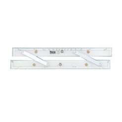
The GPS Chart Plotter provides a straightforward and effective interface between a GPS device and a paper chart. The electronics age has revolutionized the way we navigate forever. Latitude and longitude are often read straight from the display of a GPS receiver. Despite advances in electronic charting, a wise seafarer will always carry hardcopy paper charts for backup and reliability. The simple four step instructions for plotting the GPS fix are located on the back of the plastic sleeve protector.
- 15-1/2 inches (39.37cm) long
- Innovative straight-line action
- Pencil guide holes
- Sturdy clear acrylic & stainless steel/brass construction
- Non-slip pads
- Protractor & parallel rule features
- One size covers all charts
- Instructions on back of protective plastic sleeve
- Made in England


Reviews
There are no reviews yet.