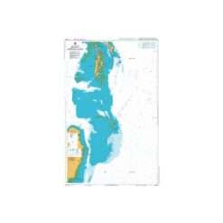
Aus125 Australian Nautical Chart Plans in South Australia Gulf of St Vincent – WITHDRAWN
Reference: AUS 125
WITHDRAWN
Description
Chart AUS125
Main Chart Details
Chart Title: Plans in South Australia Gulf of St Vincent
Publication Date: 15/11/1972
Latest Edition date: 11/02/1994
Chart Size: 1033 x 653 (mm)
Chart Panel Details
Panel Name Cape Jervis
Natural Scale 5000
North Limit 35 36′.08S
East Limit 138 05′.77E
South Limit 35 36′.77S
West Limit 138 04′.83E
Panel Name Kingscote Harbour
Natural Scale 25000
North Limit 35 37′.98S
East Limit 137 44′.44E
South Limit 35 41′.27S
West Limit 137 37′.86E
Panel Name Port Stanvac
Natural Scale 25000
North Limit 35 03′.20S
East Limit 138 29′.55E
South Limit 35 07′.85S
West Limit 138 24′.15E
Panel Name Eastern Cove and American River
Natural Scale 37500
North Limit 35 42′.90S
East Limit 137 54′.40E
South Limit 35 48′.40S
West Limit 137 46′.20E
Panel Name Glenelg
Natural Scale 12500
North Limit 34 57′.80S
East Limit 138 31′.00E
South Limit 34 59′.15S
West Limit 138 28′.66E
Panel Name Wirrina Cove
Natural Scale 10000
North Limit 35 29′.75S
East Limit 138 15′.00E
South Limit 35 30′.55S
West Limit 138 13′.10E
Panel Name Penneshaw
Natural Scale 5000
North Limit 35 42′.90S
East Limit 137 57′.19E
South Limit 36 43′.35S
West Limit 137 56′.40E

Reviews
There are no reviews yet.